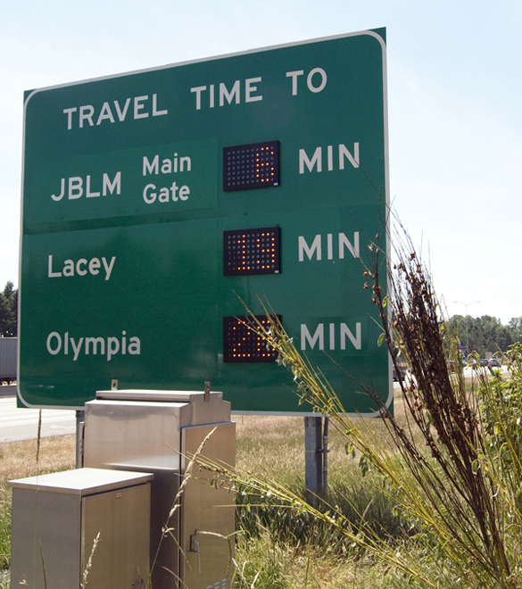
Just in time for summer vacations, drivers traveling on Interstate 5 between Lacey and Tacoma have a new source of traveler information on the road and on the Web.
Earlier this month, the Washington State Department of Transportation (WSDOT) activated five new roadway signs that display travel times on Interstate 5 between State Route 510 in Thurston County and Tukwila in King County. The five signs, located on both northbound and southbound Interstate 5, display estimated travel times so drivers can take more control over their commutes, and make on-the-road route decisions.
“Drivers will now know how long it will take to reach their destinations,” said WSDOT Olympic Region Administrator Kevin Dayton. “They can also use the information to make decisions about whether to stop for gas, get food, take a break or continue on.”
Drivers won’t have to be in their vehicles to find the travel times in Pierce and Thurston counties. Similar information is also available online here.
The four new signs in the JBLM corridor, along with ramp meters, traffic cameras, and variable-message signs are part of a federally-funded project specifically designed to help alleviate congestion through the Interstate 5 corridor by installing intelligent transportation systems tools to better manage traffic. The fifth sign posting travel times is located on Interstate 5 at the Port of Tacoma Road, using an existing variable-message sign.