How do you begin the monumental task of cataloging all the public art in Tacoma? How do you go about gauging and promoting economic development in specific pockets of the city? How do you bolster the citys emergency preparedness for such catastrophes as earthquakes and floods?
If you are a fan of Geographic Information Systems (GIS), you create maps.
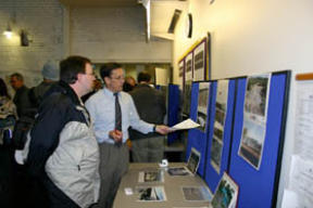
The power and potential of GIS technology was the message during this weeks GIS Day at the University of Washington Tacoma. The conference illustrated how GIS technology facilitates completion of seemingly impossible tasks such as those described above: the City of Tacoma used the technology to create an online inventory of public art, complete with interactive maps directing visitors to artwork throughout the city; the Tacoma Economic Development Department leveraged the technology to create maps that represent population demographics, crime analysis, transportation planning, and vacancy rates; and the Washington State Emergency Management Division tapped GIS resources to build models to predict the extent of damage to geographic areas impacted by natural disasters.
GIS is a computer-based mapping tool that takes information from a database about a location — such as streets, buildings, water features, and terrain — and turns it into visual layers. The ability to see geographic features on a map provides users a better understanding of a particular location, enabling planners, analysts, and others to make informed decisions about their communities.
This weeks event was part of an international conference held each year on the Wednesday of National Geographic Society’s Geography Awareness Week. The conference is designed to provide an opportunity for people curious about GIS and the UW-Tacoma technology programs to see the applications and learn about the educational opportunities.
I spoke with Tom Carlson, Ph.D. during the universitys conference. Dr. Carlson is an assistant professor of GIS at UW Tacomas Urban Studies Program.
TACOMA DAILY INDEX: Is GIS technology fairly new? How old is the certificate program at UW Tacoma?
DR. CARLSON: The field of GIS is about 15-20 years old. It really started to develop with computer cartography (making maps on computers) when computers became more common out there. The GIS Certificate Program at UW Tacoma is two years old now. This is my second year here as well. I was brought in to get the program off the ground and teach the courses.
TACOMA DAILY INDEX: This weeks conference illustrated the number of different applications for GIS technology. Describe the current job market for individuals pursuing a career in this field.
DR. CARLSON: There are job opportunities world-wide and across the United States. The current market for GIS people is ‘robust’ and increasing as the technology becomes more user friendly and knowledge about GIS spreads. Job advertisements for planners, environmental consultants, and marketing consultants are asking more and more for GIS skills as part of the knowledge, skills, and abilities of an applicant. People with a Certificate in GIS from an academic institution [represent to employers they have] taken the time to pursue a challenging field of study. The program at UW Tacoma gives the student experience in spatial modeling that they typically will not get in one or two classes anywhere else.
TACOMA DAILY INDEX: Do you find that certain types of people, such as individuals with interests in geography or mathematics, are interested in the GIS certificate program?
DR. CARLSON: People don’t need a math background or any other type of background to be interested in GIS. Once they see a part of the world with which they are familiar examined or analyzed with GIS, they tend to get interested. GIS is the ‘hub of geography if you will, and where I am serves as a bridge between various disciplines or fields. Geographers are a natural fit to be good GIS users as spatial awareness and analysis is part of their training. But anyone with some effort can become quite a good GIS analyst.
For more information, visit www.tacoma.washington.edu/urban_studies.