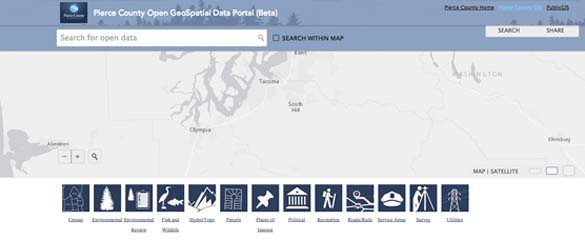
Pierce County has launched a new Geographic Information System (GIS) Web site that aims to make it easy to research census data, zoning, local parks, property parcels, and more.
According to Pierce County officials, the Open Geospatial Data Portal makes the county’s GIS data widely available to the public by allowing users to choose from categories such as census data or places of interest, search for specific topics, filter for desired data, and view data on an interactive map. The data can also be shared or saved as a spreadsheet, KML file for Google Maps, or shapefile. Pierce County officials claim the new portal will help increase economic development, improve everyday decision-making, and enhance educational opportunities for county residents.
The new GIS Web site is online at gisdata.piercecowa.opendata.arcgis.com.